


5,3 km | 5,9 km-effort

Tous les sentiers balisés d’Europe GUIDE+


Application GPS de randonnée GRATUITE
 SityTrail
IGN / Instituts géographiques
SityTrail World
Le monde est à vous
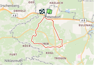
Randonnée A pied de 10,8 km à découvrir à Bavière, Landkreis Rosenheim, Bad Feilnbach. Cette randonnée est proposée par SityTrail - itinéraires balisés pédestres.
Randonnée créée par Bad Feilnbach.
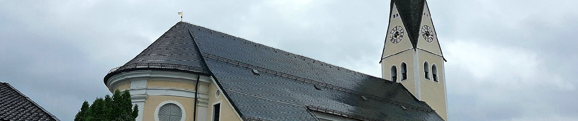
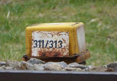
2018 schon einige beschädigte Schilder. Wird scheinbar nicht mehr gepflegt.
Symbole: Rote Schilder mit weißem Pfeil
 "
data-pinterest-text="Pin it"
data-tweet-text="share on twitter"
data-facebook-share-url="https://www.sitytrail.com/fr/trails/3095807-bad-feilnbach--nordic-walking-rot-xeckersbergx/?photo=1#lg=1&slide=1"
data-twitter-share-url="https://www.sitytrail.com/fr/trails/3095807-bad-feilnbach--nordic-walking-rot-xeckersbergx/?photo=1#lg=1&slide=1"
data-googleplus-share-url="https://www.sitytrail.com/fr/trails/3095807-bad-feilnbach--nordic-walking-rot-xeckersbergx/?photo=1#lg=1&slide=1"
data-pinterest-share-url="https://www.sitytrail.com/fr/trails/3095807-bad-feilnbach--nordic-walking-rot-xeckersbergx/?photo=1#lg=1&slide=1">
"
data-pinterest-text="Pin it"
data-tweet-text="share on twitter"
data-facebook-share-url="https://www.sitytrail.com/fr/trails/3095807-bad-feilnbach--nordic-walking-rot-xeckersbergx/?photo=1#lg=1&slide=1"
data-twitter-share-url="https://www.sitytrail.com/fr/trails/3095807-bad-feilnbach--nordic-walking-rot-xeckersbergx/?photo=1#lg=1&slide=1"
data-googleplus-share-url="https://www.sitytrail.com/fr/trails/3095807-bad-feilnbach--nordic-walking-rot-xeckersbergx/?photo=1#lg=1&slide=1"
data-pinterest-share-url="https://www.sitytrail.com/fr/trails/3095807-bad-feilnbach--nordic-walking-rot-xeckersbergx/?photo=1#lg=1&slide=1">
 "
data-pinterest-text="Pin it"
data-tweet-text="share on twitter"
data-facebook-share-url="https://www.sitytrail.com/fr/trails/3095807-bad-feilnbach--nordic-walking-rot-xeckersbergx/?photo=2#lg=1&slide=2"
data-twitter-share-url="https://www.sitytrail.com/fr/trails/3095807-bad-feilnbach--nordic-walking-rot-xeckersbergx/?photo=2#lg=1&slide=2"
data-googleplus-share-url="https://www.sitytrail.com/fr/trails/3095807-bad-feilnbach--nordic-walking-rot-xeckersbergx/?photo=2#lg=1&slide=2"
data-pinterest-share-url="https://www.sitytrail.com/fr/trails/3095807-bad-feilnbach--nordic-walking-rot-xeckersbergx/?photo=2#lg=1&slide=2">
"
data-pinterest-text="Pin it"
data-tweet-text="share on twitter"
data-facebook-share-url="https://www.sitytrail.com/fr/trails/3095807-bad-feilnbach--nordic-walking-rot-xeckersbergx/?photo=2#lg=1&slide=2"
data-twitter-share-url="https://www.sitytrail.com/fr/trails/3095807-bad-feilnbach--nordic-walking-rot-xeckersbergx/?photo=2#lg=1&slide=2"
data-googleplus-share-url="https://www.sitytrail.com/fr/trails/3095807-bad-feilnbach--nordic-walking-rot-xeckersbergx/?photo=2#lg=1&slide=2"
data-pinterest-share-url="https://www.sitytrail.com/fr/trails/3095807-bad-feilnbach--nordic-walking-rot-xeckersbergx/?photo=2#lg=1&slide=2">
 "
data-pinterest-text="Pin it"
data-tweet-text="share on twitter"
data-facebook-share-url="https://www.sitytrail.com/fr/trails/3095807-bad-feilnbach--nordic-walking-rot-xeckersbergx/?photo=3#lg=1&slide=3"
data-twitter-share-url="https://www.sitytrail.com/fr/trails/3095807-bad-feilnbach--nordic-walking-rot-xeckersbergx/?photo=3#lg=1&slide=3"
data-googleplus-share-url="https://www.sitytrail.com/fr/trails/3095807-bad-feilnbach--nordic-walking-rot-xeckersbergx/?photo=3#lg=1&slide=3"
data-pinterest-share-url="https://www.sitytrail.com/fr/trails/3095807-bad-feilnbach--nordic-walking-rot-xeckersbergx/?photo=3#lg=1&slide=3">
"
data-pinterest-text="Pin it"
data-tweet-text="share on twitter"
data-facebook-share-url="https://www.sitytrail.com/fr/trails/3095807-bad-feilnbach--nordic-walking-rot-xeckersbergx/?photo=3#lg=1&slide=3"
data-twitter-share-url="https://www.sitytrail.com/fr/trails/3095807-bad-feilnbach--nordic-walking-rot-xeckersbergx/?photo=3#lg=1&slide=3"
data-googleplus-share-url="https://www.sitytrail.com/fr/trails/3095807-bad-feilnbach--nordic-walking-rot-xeckersbergx/?photo=3#lg=1&slide=3"
data-pinterest-share-url="https://www.sitytrail.com/fr/trails/3095807-bad-feilnbach--nordic-walking-rot-xeckersbergx/?photo=3#lg=1&slide=3">
 "
data-pinterest-text="Pin it"
data-tweet-text="share on twitter"
data-facebook-share-url="https://www.sitytrail.com/fr/trails/3095807-bad-feilnbach--nordic-walking-rot-xeckersbergx/?photo=4#lg=1&slide=4"
data-twitter-share-url="https://www.sitytrail.com/fr/trails/3095807-bad-feilnbach--nordic-walking-rot-xeckersbergx/?photo=4#lg=1&slide=4"
data-googleplus-share-url="https://www.sitytrail.com/fr/trails/3095807-bad-feilnbach--nordic-walking-rot-xeckersbergx/?photo=4#lg=1&slide=4"
data-pinterest-share-url="https://www.sitytrail.com/fr/trails/3095807-bad-feilnbach--nordic-walking-rot-xeckersbergx/?photo=4#lg=1&slide=4">
"
data-pinterest-text="Pin it"
data-tweet-text="share on twitter"
data-facebook-share-url="https://www.sitytrail.com/fr/trails/3095807-bad-feilnbach--nordic-walking-rot-xeckersbergx/?photo=4#lg=1&slide=4"
data-twitter-share-url="https://www.sitytrail.com/fr/trails/3095807-bad-feilnbach--nordic-walking-rot-xeckersbergx/?photo=4#lg=1&slide=4"
data-googleplus-share-url="https://www.sitytrail.com/fr/trails/3095807-bad-feilnbach--nordic-walking-rot-xeckersbergx/?photo=4#lg=1&slide=4"
data-pinterest-share-url="https://www.sitytrail.com/fr/trails/3095807-bad-feilnbach--nordic-walking-rot-xeckersbergx/?photo=4#lg=1&slide=4">

A pied
A pied
A pied
A pied
A pied
A pied
A pied
A pied
A pied